File:France population density 40pc.png

Summary
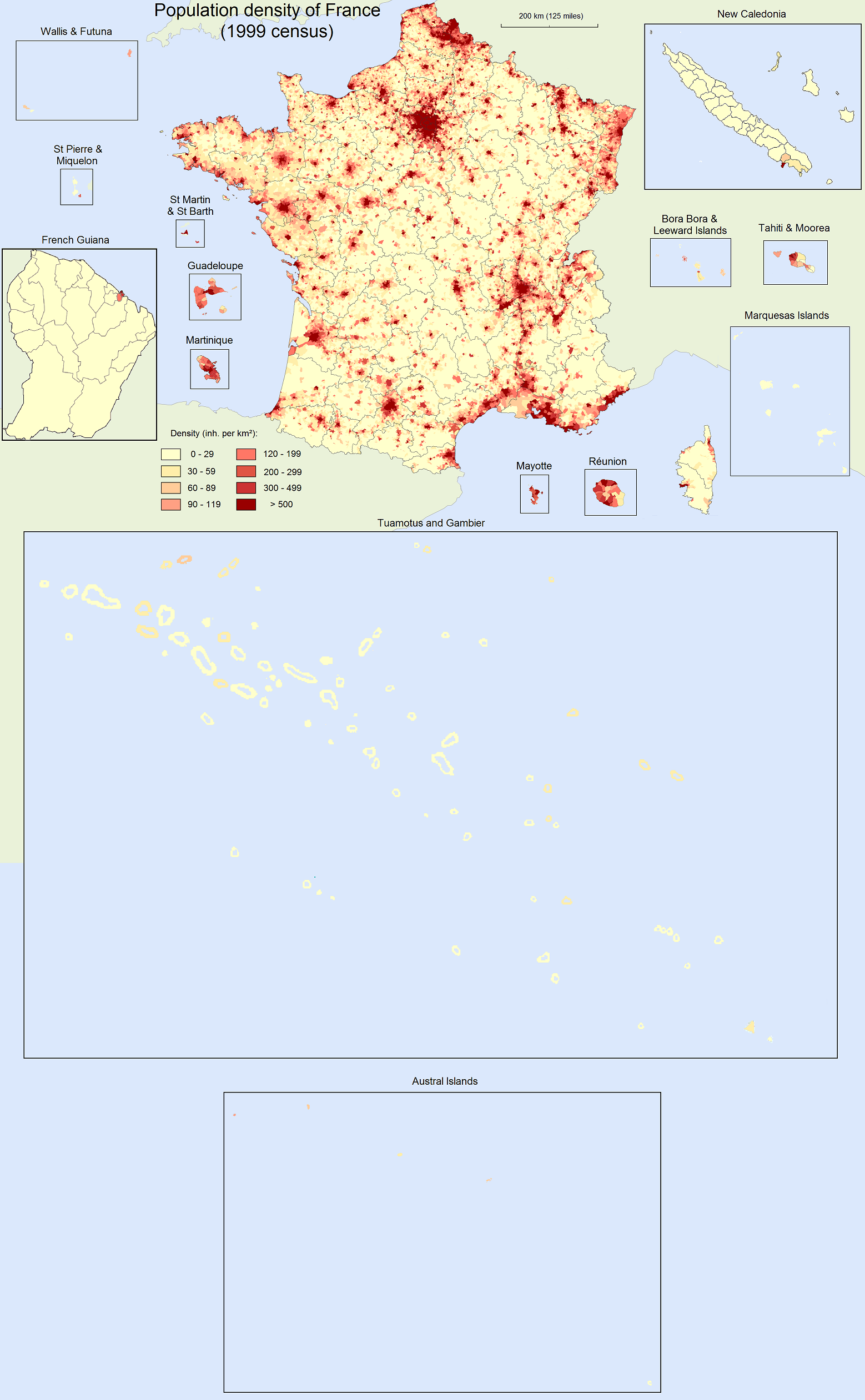
Population density map of France (40% of original). For the original (more detailed) version of the map, see: <a class="external text" href="http://upload.wikimedia.org/wikipedia/commons/f/fe/France_population_density.png">France_population_density.png</a>.
Density is as of 1999 census for Metropolitan France, Réunion, French Guiana, Martinique, Guadeloupe, St Martin & St Barth, and St Pierre & Miquelon. Density is as of 2002 census for Mayotte, Tahiti & Moorea, Bora Bora & Leeward Islands, Marquesas Islands, Tuamotus & Gambier, and Austral Islands. Density is as of 2003 census for Wallis & Futuna. Density is as of 2004 census for New Caledonia.
Licensing
Lua error in package.lua at line 80: module 'strict' not found.
File history
Click on a date/time to view the file as it appeared at that time.
| Date/Time | Thumbnail | Dimensions | User | Comment | |
|---|---|---|---|---|---|
| current | 00:08, 4 January 2017 | | 1,246 × 2,018 (537 KB) | 127.0.0.1 (talk) | Population density map of France (40% of original). For the original (more detailed) version of the map, see: <a class="external text" href="http://upload.wikimedia.org/wikipedia/commons/f/fe/France_population_density.png">France_population_density.png</a>. <br><br>Density is <b>as of 1999 census</b> for Metropolitan France, Réunion, French Guiana, Martinique, Guadeloupe, St Martin & St Barth, and St Pierre & Miquelon. Density is <b>as of 2002 census</b> for Mayotte, Tahiti & Moorea, Bora Bora & Leeward Islands, Marquesas Islands, Tuamotus & Gambier, and Austral Islands. Density is <b>as of 2003 census</b> for Wallis & Futuna. Density is <b>as of 2004 census</b> for New Caledonia. |
- You cannot overwrite this file.
File usage
The following 2 pages link to this file: