Rainy Lake
<templatestyles src="Module:Hatnote/styles.css"></templatestyles>
| Rainy Lake | |
|---|---|

Rainy Lake from Tango Channel
|
|

Rainy Lake
Location of Rainy Lake on the USA/Canada Border between Minnesota and Ontario
|
|
 |
|
| Location | Minnesota, United States; Ontario, Canada |
| Coordinates | Lua error in package.lua at line 80: module 'strict' not found. |
| Type | remnant of former glacial Lake Agassiz |
| Primary inflows | Namakan Lake Kabetogama Lake Seine River |
| Primary outflows | Rainy River |
| Basin countries | Canada, United States |
| Max. length | 80 km (50 mi) |
| Max. width | 48 km (30 mi) |
| Surface area | 932 km2 (360 sq mi) |
| Max. depth | 50 m (160 ft) highly variable |
| Shore length1 | 1,500 km (930 mi) 2,520 km (1,570 mi) (w/ Islands) highly irregular, rocky shoreline |
| Surface elevation | 338 m (1,109 ft) |
| Islands | ~2,568[1] |
| Settlements | International Falls, MN Fort Frances, Ontario |
| 1 Shore length is not a well-defined measure. | |
Rainy Lake (French: lac à la Pluie; Ojibwe: gojiji-zaaga'igan) is a relatively large freshwater lake (360 square miles (930 km2)) straddling the border between the United States and Canada. The Rainy River issues from the west side of the lake and is harnessed to make hydroelectricity for US and Canadian locations. The sister cities of International Falls, Minnesota, and Fort Frances, Ontario, are situated on either side of the outflow of the river from the lake. Rainy Lake and Rainy River establish the boundary between the two countries. [2]
Voyageurs National Park is located on the southeastern corner of the lake, where it connects with Kabetogama and Namakan Lakes at Kettle Falls. Rainy Lake is part of an extremely large system of lakes forming the Hudson Bay drainage basin that stretches from west of Lake Superior north to the Arctic Ocean. The Rainy Lake watershed includes the Boundary Waters Canoe Area Wilderness (BWCA), portions of the Superior National Forest on the US side of the border, and the Quetico Provincial Park on the Canadian side of the border.[3]
For exploration and fur trade history see Winnipeg River and additional references below. [4] [5]
Contents
Name
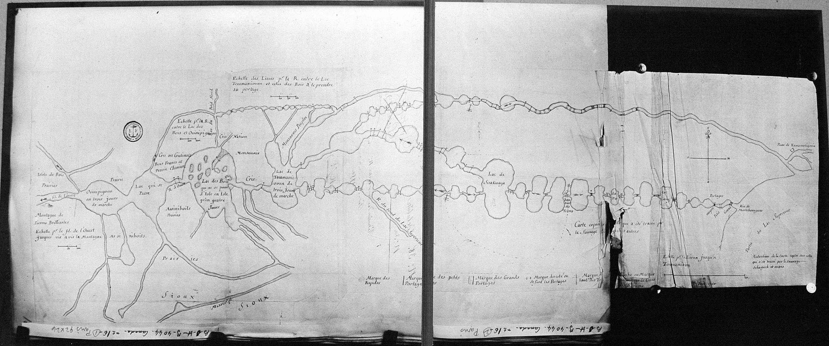
Earliest documentation of the lake's name is "Tekamamiwen" (shown as "Lac de Tecamamiouen" on the Ochagach map (c. 1728), as "Lac Tacamamioüer" on the 1739 de l'Isle map, as "Lake Tecamaniouen" on the 1757 Mitchell Map and as "Lake Tekamamigovouen" on the Thomas Jefferys' 1762 Map of Canada). Pierre Gaultier de Varennes, sieur de La Vérendrye cites that the name was a corruption from the Cree "taki-kimiwen", meaning "It always is raining", referring to the Rainy River, though the language does not quite support that claim.[6] He also cites that the lake was also known as "Ouichichick" (Ojibwe word Gojijiing or Cree Kocicīhk, both meaning "at the place of inlets"). Early documents lists the portion of Rainy Lake east of the Brule Narrows as "Cristinaux [Cree] Lake"[7] or as "Little Lake."[8]
Recreation on Rainy Lake
Voyageurs National Park
On Rainy Lake, Voyageurs National Park maintains an extensive network of over boat-in camping sites, hiking trails, and designated snowmobile trails for winter use.
Fishing
The lake is popular for sport and recreational fishing for species such as Walleye, Northern pike, Muskellunge, Crappie, Largemouth and Smallmouth bass, which are all considered excellent freshwater sportfish. Rainy Lake is home to the annual Canadian Bass Championship, which has occurred every summer since 1996. The lake is dotted with many small islands on both the Canadian and American sides; they are the sites of numerous fishing cabins, small fishing resorts, and vacation homes. Fishing tourism is an important part of the local economy.
Rendezvous Yacht Club
Rainy Lake is home to the Rendezvous Yacht Club.
Winter activities
Winter access to Rainy Lake by car is provided by an ice road maintained by the National Park Service. Popular winter sports include ice fishing, cross-country skiing, snowshoeing, and snowmobiling.
Governance
Applicable laws
Rainy Lake spans the international border separating Canada and USA. The laws of Canada and the Province of Ontario apply to the portions of the lake on the Canadian side of the border; the laws of the USA and the State of Minnesota apply to those portions on the US side of the border. The relevant law enforcement agencies of each country are responsible for the portions of the lake within their borders. The Canadian and U.S. Coast Guards maintains navigational aids on their respective sides of the border. Boaters and fishermen must be aware of the requirements imposed by relevant jurisdictions (Canada, USA) while traveling or fishing on Rainy Lake.
Border crossing
Visitors to Canada must report to a Canadian customs office before going ashore in Canada. However, US and Canadian citizens and permanent residents traveling on the lake who wish to go ashore can apply for CANPASS Remote Area Border Crossing (RABC) permit allowing them to enter into Canada without reporting to Canadian customs. Boaters entering US waters from Canada, and who are citizens or permanent residents of the US and Canada, can apply for the Canadian Border Boat Landing Program (I-68 Permit Program) which allows them to report to US Customs and Border Protection by telephone. With proper documentations these permits can be obtained at the US and Canadian customs offices located near the International Bridge in International Falls and Fort Frances, respectively.
Water level management
The level of Rainy Lake is controlled at the hydro-electric power houses of the international dam that spans the Rainy River between International Falls and Fort Frances, at two water-control dams located at Kettle Falls where the outflow from Namakan Lake enters Rainy Lake, and at the Sturgeon Falls Generating Station located on the Seine River. The companies that own and operate the powerhouses (Boise Paper on the U.S. side and H2O Power Limited Partnership on the Canadian side) are responsible for maintaining lake level and flow changes from the dams within normal ranges, subject to regulatory oversight by the International Rainy-Lake of the Woods Watershed Board (IRLWWB). The IRLWWB is a board of the International Joint Commission (IJC), which is a bi-national organization created out of the International Boundary Waters Treaty of 1909 for the purposes of handling boundary water issues between the United States and Canada.
Geology
Geologically Rainy Lake is part of the Superior Craton of the Canadian Shield and retains features associated with it, such as a large, ancient caldera and fault lines that can be clearly seen in satellite images of the lake. [9] The Rainy Lake - Seine River Fault zone is a strike-slip fault zone passing through Rainy Lake from Tilson Bay in the southwest to Seine Bay in the northeast. [10] The Quetico Fault passes through Rainy Lake on an east-west path through McDonald Inlet. [11] The fault system forms a triangular wrench zone separating the granite-greenstone terrain of the Wabigoon subprovince to the north from the metasedimentary terrain of the Quetico subprovince to the south. [12]
The rock under the lake and exposed on many of its islands is an exposed part of the North American craton composed of ancient Precambrian rock. This rock has been significantly affected by glaciation, which dominates much of the recent geologic history of the area.
Popular culture
Rainy Lake (Rainy River) plays a pivotal role in Tim O'Brien's novel, The Things They Carried. Other novels set on Rainy Lake include
- Wilder's Edge by Diane Bradley, published by North Star Press of St. Cloud, 2013.
- Wilder's Foe by Diane Bradley, published by North Star Press of St. Cloud, 2014.
- Frozen by Mary Casanova, published by University of Minnesota Press, 2012.
- When Eagles Fall by Mary Casanova, published by University of Minnesota Press, 2014.
Non-fiction works set on Rainy Lake include
- Fawn Island by Doug Woods, published by University of Minnesota Press, 2001.
Gallery
-

Morans Bay of Rainy Lake
-

Sunrise on Rainy Lake
-

Sunset over Rainy Lake
-

Little American Island
-

Black Bay
-

Channel between islands on Rainy Lake.
-

Lost Bay
-

Nightscape on Sand Bay
-

Channel at Kettle Falls
-

Sand Bay
-

Mermaid Sculpture on Rainy Lake[13]
-

Rainy Lake Shoreline
-

Brule Narrows


See also
- Boundary Waters Canoe Area Wilderness
- Ernest Oberholtzer
- Kettle Falls Historic District
- Koochiching County, MN
- Quetico Provincial Park
- Rainy River
- Rainy River District, Ontario
- Voyageurs National Park
References
- ↑ Rahm, Joe. Island Images: Rainy Lake’s missing islands. The Journal. 14 Feb. 2010.
- ↑ Lua error in package.lua at line 80: module 'strict' not found.
- ↑ Lua error in package.lua at line 80: module 'strict' not found.
- ↑ Lua error in package.lua at line 80: module 'strict' not found.
- ↑ Lua error in package.lua at line 80: module 'strict' not found.
- ↑ Lua error in package.lua at line 80: module 'strict' not found.
- ↑ Lua error in package.lua at line 80: module 'strict' not found.
- ↑ Lua error in package.lua at line 80: module 'strict' not found.
- ↑ Lua error in package.lua at line 80: module 'strict' not found.
- ↑ Lua error in package.lua at line 80: module 'strict' not found.
- ↑ Lua error in package.lua at line 80: module 'strict' not found.
- ↑ Lua error in package.lua at line 80: module 'strict' not found.
- ↑ Lua error in package.lua at line 80: module 'strict' not found.