Mount Binuluan
| Mount Binuluan | |
|---|---|
|
|
| File:Binubulauan02.jpg
Mount Binuluan as viewed from the village of Bangtitan in Upper Uma, Lubuagan
|
|
| Highest point | |
| Elevation | Lua error in Module:Convert at line 1851: attempt to index local 'en_value' (a nil value). |
| Listing | Active volcanoes in the Philippines |
| Coordinates | Lua error in package.lua at line 80: module 'strict' not found. |
| Geography | |
.svg)
Binuluan Volcano
Location within the Philippines
|
|
| Location | Luzon |
| Country | Philippines |
| Region | Cordillera Administrative Region |
| Province | Kalinga |
| Municipalities | |
| Parent range | Cordillera Central |
| Topo map | 7277-IV |
| Geology | |
| Mountain type | Stratovolcano |
| Volcanic arc/belt | Luzon Central Cordillera Belt |
| Last eruption | 1952 (?), 1986 (?) |
| Climbing | |
| First ascent | Unknown |
| Easiest route | Unknown |
Mount Binuluan (also known as Ambalatungan) is a remote volcano in the Kalinga province of the Cordillera Administrative Region of the Philippines. The 2,329-metre-high (7,641 ft) mountain is part of the Cordillera Central mountain range on Luzon island, the largest island in the country. Binuluan exhibits active volcanism through numerous fumarole fields, solfataras and hot springs on its slope. There were reports of possible eruptions in 1952 and 1986 (or 1987), but they are unverified.
Contents
Geography
Mount Binuluan [Bin-oo-loo-ahn (Lubuaganyen dialect)] is one of the highest peaks in the area. The mountain is surrounded by the municipalities of Lubuagan, Pasil and Tinglayan in Kalinga province.
-
PasilRiverValley81023acg.jpg
Pasil River Valley northwest of Mount Binuluan with the slopes of Binuluan in the foreground
-

Chico River Valley southeast of Binuluan as seen from Tinglayan

Southeast of the mountain is the Chico River flowing from southwest to northeast direction, while due northwest of the mountain is Pasil River, also flowing from southwest to northeast direction merging with Chico River just past the mountain. Mount Binuluan belongs to a range of mountains situated between the two rivers, trending southwest to northeast. Just southwest of Binuluan is Mount Mosimus 2,178 m (7,146 ft), followed by Mount Cauitan 2,569 m (8,428 ft) and Mount Alchan (Alchanon) 2,567 m (8,422 ft), the 19th and 20th tallest mountain in the Philippines.[1][2] South of this line of mountains are Mount Chumangil 1,996 m (6,549 ft) and Mount Patoc 1,819 m (5,968 ft), the other volcano of the Central Cordillera Range displaying strong fumarolic activity.
Geology
The Smithsonian Institution's Global Volcanism Program list Binuluan under Ambalatungan Group. The dacitic little-known cluster of volcanoes [called Ambalatungan by Alvir (1956)[3] and the Philippine Commission of Volcanology (1981), and as Mount Binuluan by Wolfe (1982)] was described as consisting of three volcanoes constructed along a roughly E-W line. Binuluan volcano contains a steep-walled crater with hot springs and vigorous sulfur-encrusted fumarolic vents that produce loud noises. Bumabag volcano, 3 kilometres (1.9 mi) east of Binuluan, has two craters that also show strong fumarolic activity. Podakan volcano, 1 kilometre (0.62 mi) SE of Bumabag, also has a large steam vent.[4] The Bumabag and Podakan volcanoes could possibly be flank vents of Mount Binuluan.[5][6]
The Philippines Institute of Volcanology and Seismology (PHIVOLCS) lists Binuluan or Ambalatungan as an inactive volcano.[7]
Other studies
Mount Binuluan is usually covered in cloud or mist and so photographs could be difficult to obtain. The village of Bangtitan in Upper Uma in Lubuagan is a good vantage point for views and photography of the mountain on the rare occasions when the primary peak is not mist-enshrouded. It is not known if Binuluan itself has ever been climbed as access to the site is very difficult. The terrain is rugged and undeveloped.
There has been some geological surveying related to the Batong Buhay gold mining activities in Pasil, but the locals say no one has ever climbed or surveyed Binuluan because it is "too far away", "there's no reason to go there", "it is too difficult climbing that", and "even the geologists didn't bother".
Groundwork in 2007 and 2008 as part of a comprehensive systematic survey, shows volcanic-related activities around Binuluan, from northwestward of the peak, going counterclockwise, to eastward side of the peak.
Further groundwork was abandoned due to tribal conflicts on the southwest flank (Tinglayan-Tulgao tribal conflict), and unrelated intertribal conflicts on the northwest and northeast flanks (Upper Uma-Lubuagan conflict).
In 2008, the Department of Energy approved two local firms, Aragorn Power and Energy Corp. (APEC) and Guidance Management Corp. (GMC) to jointly explore 26,250-hectare (64,900-acre) area in the municipalities of Pasil, Tinglayan, and Lubuagan for geothermal energy feasibility studies.[8]
Geothermal features
Mount Binuluan exhibits a number of active geothermal features. There are a number of sites with strong steam emission, fumarolic activity, surface sulfur deposits, hot fresh water springs, hot sulfurous water springs, sulfur staining of riverine rocks, poisonous gas emissions, recent volcanic gas related deaths (>100 in last 20 years at Batong Buhay mines alone), heat destruction of vegetation, poisonous water, fumarole fields with new and shifting activity.
Bu-ot Fumarole Field
The Bu-ot Fumarole Field (Balatoc dialect) is located on Balatoc tribal land, along the Pasil River on the steep western valley slope, with the path going up to Balatoc village immediately to the right of the fumarole field.
-
Bu-ot80420cga.jpg
Bu-ot Fumarole Field
-
Bu-ot80420cgb.jpg
Steep-sided Bu-ot Fumarole Field
-
PasilRiver80420acg.jpg
Heavily sulfur-stained Pasil River, upstream from Bu-ot Fumarole Field
The steep area is located at approximately Lua error in package.lua at line 80: module 'strict' not found. at an elevation of about 754 metres (2,474 ft) above sea level. There are two active steam vents with yellow sulfuric water flowing out, as well as from some other locations in the field, down to the Pasil River. The rocks along the Pasil River are heavily stained orange-yellow both upstream and downstream from the Bu-ot fumarole field.
Bum-bag Fumarole Fields
Bum-bag fumarole fields [pron. Boom-bag (Balatoc dialect)], (or Djum-ag in Upper Uma dialect), are located approximately 3 kilometres (1.9 mi) east of Bu-ot, on Batong Buhay tribal land in Pasil. The fields are on the eastern side of the Pasil River valley at an elevation of about 1,437 metres (4,715 ft) above sea level. One walks through the Bum-bag rice terraces located at an elevation of about 1,182 metres (3,878 ft), to get to the fumarole fields. The fields though are located in a private property. The owner of the property reported that the underground rattling, banging, and explosions stopped years ago, but he could not be any more specific as to time, and was not specific about which particular field. Bum-bag fumarole fields appear to be consistent with the GVP's 'Bumabag Volcano', but it is located 3 kilometres (1.9 mi) west of the summit, not east.
-
Djumag1898.jpg
Bum-bag Fumarole Fields from a distance
-
Bum-bagRiceTerraces80420acg.jpg
Bum-bag Rice Terraces
-
Bum-bagFumarole-1Field80420acg.jpg
Bum-bag Fumarole Field #1
-
Bum-bag1stFumaroleFieldacg80420.jpg
A closer look of Bum-bag Fumarole Field #1
- Field 1, located about 100 metres (330 ft) north of Field 2 has about 11 separate fumarole vents, and covers about 2 hectares (4.9 acres), and was the most active of Fields 1, 2 and 3 as of 2008.
- Field 2, (approximate location Lua error in package.lua at line 80: module 'strict' not found.) has 16 separate fumarole vents, and covers about 2 hectares (4.9 acres) in 2008.
-

Bum-bag Fumarole Field #2
-
Djumag1929.JPG
Armed private guards at Bum-bag Fumarole Field #2
-
Bum-bag3rdFumaroleField80420acg.jpg
Bum-bag Fumarole Field #3

- Field 3 is located about 250 metres (820 ft) south of field 2.
- Field 4, located about 1 kilometre (0.62 mi) SE of Field 2 is believed to have the largest surface deposit of sulfur among the fields and is the most active. Field 4 may be consistent with the GVP's 'Podakan Volcano'.
There were broad swathes of bare ground between the numbered fields where all vegetation was absent except broken scorched trunks of mature pine tree. Besides the four fields, there could be another field over the ridge to the north of field 1, but it is unexplored.
Sugo-oc fumarole field
The Sugo-oc fumarole field could be seen and photographed from the southern side of Binuluan in Bunog River valley, along the Tinglayan-Tulgao road. Unfortunately mist, cloud, and intermittent rain could easily prevent all photography. The fumarole field can be accessed through Dananao, Tulgao or Sumadel in Tinglayan.
Hot Springs
Numerous hot springs, both fresh water, and sulfurous water, exist in a wide half ring around the south and western sides of Binuluan. Bu-ot fumarole field, Bum-bag fumarole fields, and Sugu-oc fumarole field, all have hot sulfurous water springs. Along the Pasil River upstream from Bu-ot, six hot sulfurous water springs and one fumarole are said to be located.
Sun-ut hot spring
Downstream from Bu-ot on the Sun-ut River below the village of Ag-agama, is the Sun-ut hot sulfur water spring. The local priest in Ag-agama says there used to be a natural bowl on the banks of the Sun-ut River into which the spring flowed and in which the people of Ag-agama bathed daily. But a typhoon-induced flooding of the Sun-ut river washed away the bowl and now the spring flows directly into the river. The spring is located on private property, the owner, living in Ag-agama. Further information from locals may disclose the other hot water springs in tributaries off the Pasil River upstream from Bu-ot.
Bunog Falls and hot springs
Along the Bunog River, downstream from Bunog Falls below Tulgao West, are numerous hot sulfurous springs. The first spring is visible from Bunog Falls, about 100 metres (330 ft) downstream from the Bunog Falls' hot freshwater springs. According to Tulgao and Tinglayan locals, there was a hot salt water spring on the Bunog River which used to be harvested and the water 'cooked' (evaporated) to produce salt, before the Cordillera Highway was first blazed. Also, according to them, one of the springs is poisonous killing animals and birds which drink from it. There are no paths along the Bunog River to get to the other springs.
Locals in Tinglayan and Lubuagan do not know any other hot sulfur water springs in the Chico River or its tributaries other than Bunog River.
Possible eruptions
A possible phreatic or steam eruption was reported from Mount Binuluan in 1952, during which a sulfur-rich debris flow killed a dozen people.[4] Details about the eruption in 1952 are still scant. In 2007 and 2008, some 90- and 100-year-old elders in Brgy. Tulgao in Tinglayan said the loss of life in 1952 was caused by an eruption during a typhoon followed with the collapse of a natural earth bank below Sugo-oc fumarole field, high on the northern side of the Bunog River. The consequent mudslide buried a few houses below near the villages of Dananao and Sumadel, Tinglayan, killing maybe 12 people or thereabouts.
In 2007 and 2008, people in southern Kalinga around Binuluan spoke of an 'eruption' at Sugo-oc in 1986 or 1987. During the Abra earthquake at 20:16 hours on Sunday, January 13, 2008, buildings in Tinglayan shook and windows rattled for about 10 seconds. When speaking in English, the locals there at the time called this an 'eruption'. Gentle questioning of locals over months led to the conclusion that there are difficulties in communicating the difference between an eruption and an earthquake.
There were reports about that earthquake of 1986, which was felt also felt throughout the municipality of Lubuagan, was simultaneous with an eruption at Sugo-oc resulting in the ejection of ash and rock. Three people in Dananao village were killed by the ejected rocks. Because of these, there was a large migration out of the village with the Dananao people taking possession of a land along the Tubuk-to-Aurora Road in eastern Kalinga and resettling there.
Accessibility
From Manila to Bontoc or Tabuk
Visiting the thermal features of Mount Binuluan, the visitor has to travel to Bontoc, the capital of Mountain Province, or to Tabuk, the capital of Kalinga province to Pasil or Tinglayan in Kalinga. From Manila one can travel to Tabuk, by car or coach, a journey of about 10 hours at night or longer by day. From Manila to Bontoc by bus or 4-wheel drive vehicle takes about 10 hours at night.
From Tabuk to Tinglayan (SE slope)
From Tabuk, there are minibuses for Bontoc via Lubuagan or Tinglayan that depart at 8:00 a.m. for first trip. The road is rough but scenery is quite spectacular. Passengers can sit on the roof for a bit of rough adventure, but offering the best view.[9]
From Bontoc to Tinglayan (SE slope)
From Bontoc, a minibus leaves for Tabuk at about 8:00 a.m., and jeepneys also leave in the morning. Traveling this way from the south, after about 4 hours exit the bus at Tinglayan in the Chico River Valley.
A reliable local guide from Tinglayan (where reasonable accommodation is available)[10] can take you to either Tulgao or Sumadel by foot – about 3 hours hike. Most of the year there is rain or mist along these paths and appropriate warm waterproof clothing is necessary. Along the Bunog River from Tulgao to Tinglayan are a number of hot clean water springs.
In Tulgao or Sumadel, you need to negotiate to find a local guide willing to take you to the Sugo-oc fumarole field. The trek from the village to the fumarole field is steep, difficult, at higher elevation, along carabao (water buffalo) tracks. As of 2008, tourists do not visit Sugo-oc and special arrangements need to be made. There is no western style accommodation in the villages of Tulgao or Sumadel, and no accommodation at all at Sugo-oc. There is a little used foot track from Sumadel to the plateau on the southern flank of Binuluan but requires some months of planning and negotiation and a high level of fitness.
From Tabuk to Pasil River Valley (NW slope)

From Tabuk, the capital of Kalinga province, one jeepney leaves about 7:00 a.m. for Batong Buhay in the Pasil River Valley. If there is sufficient demand a second jeepney may leave about 8:00 a.m.. Traveling this way from the north is about 5 hours. Four-wheel drive and high clearance is required for any private vehicle. There are no signposts and local knowledge is needed. There is no western style accommodation anywhere in the Pasil River Valley (2008).
Alight at Ag-agama drop-off to see the Sun-ut hot sulfur water spring. Alight at Balatoc drop-off and walk towards the village of Balatoc to see the Bu-ot fumarole field along the way, and the orange-yellow stained rocks of the Pasil River. At Balatoc, you might be able to arrange a local guide to take you to Bum-bag fumarole firld. Most of the walk is on tribal lands or private property. Walk from Balatoc to Bum-bag is only for the fit and takes about 5 hours one way. There are no accommodations near Bum-bag fumarole field although there are some very basic huts at the Bum-bag rice terraces. Bum-bag fields are located on private property and permission is required from the owner.
Peace and order
Kalinga is a tribal area and is often subjected to intertribal conflict which can quickly escalate to armed warfare with deaths. Most tribes have peace pacts with other tribes, but some tribes refuse to enter into the peace pact system. Tribal law (customary law) is recognized by the Republic Government and takes precedence over republic law. A person who trespasses, damages property, hurts another person, or kills another person, is likely to be dealt with under tribal law.
Foreigners and lowlanders are not covered by the peace pact process and need to be extremely careful if entering any of the lands around Binuluan. Local guides/guards are needed at all times. Visitors should inquire about the latest peace and order situation in the Kalingas before proceeding to the area.
See also
- List of active volcanoes in the Philippines
- List of potentially active volcanoes in the Philippines
- List of inactive volcanoes in the Philippines
References
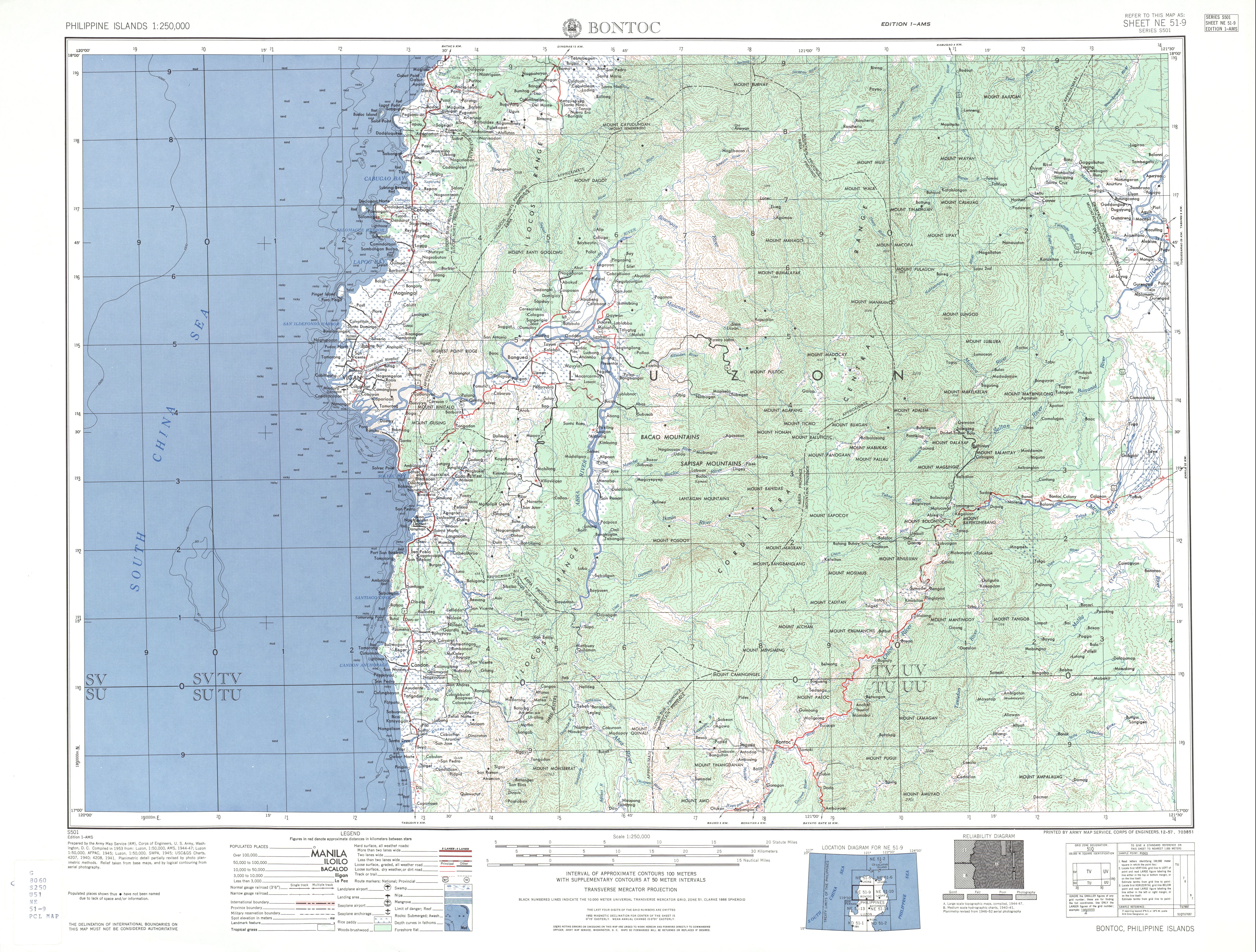
- ↑ "Bontoc Topographical Map". University of Texas in Austin Library. Retrieved on 2011-12-20.
- ↑ "The Highest Mountains in the Philippines". Pinoy Mountaineer. Retrieved on 2011-12-21.
- ↑ Alvir A D, 1953. A cluster of little known Philippine volcanoes. Proc 8th Pacific Sci Cong, 1953, 2: 205-206
- ↑ 4.0 4.1 Lua error in package.lua at line 80: module 'strict' not found.
- ↑ "Ambalatungan Synonyms & Sub-features". Global Volcanism Program. Retrieved on 2011-12-19.
- ↑ "Ambalatungan Group". Google Maps. Retrieved on 2011-12-28.
- ↑ "Inactive volcanoes of the Philippines Part 1". Philippine Institute of Volcanology and Seismology. Retrieved on 2011-12-16.
- ↑ Albano, Jr., Estanislao (2008-10-01). "DoE approves geothermal project in Kalinga town". Barangay RP. Retrieved on 2011-12-20.
- ↑ "Buses from Pagudpud to Tabuk and Bontoc". Lonely Planet. Retrieved on 2012-01-17.
- ↑ "Tinglayan - Kalinga Province". Travel-Philippines.com. Retrieved on 2012-01-17.