Baarle-Hertog
<templatestyles src="Module:Hatnote/styles.css"></templatestyles>
| Baarle-Hertog | |||
|---|---|---|---|
| Municipality | |||

Former town hall
|
|||
|
|||

Baarle-Hertog
|
|||
| <templatestyles src="Template:Hidden begin/styles.css"/>
Location of Baarle-Hertog in the province of Antwerp
 |
|||
| Coordinates: Lua error in package.lua at line 80: module 'strict' not found. | |||
| Country | Belgium | ||
| Community | Flemish Community | ||
| Region | Flemish Region | ||
| Province | Antwerp | ||
| Arrondissement | Turnhout | ||
| Government | |||
| • Mayor | Leo van Tilburg (CDK) | ||
| • Governing party/ies | CDK | ||
| Area | |||
| • Total | 7.48 km2 (2.89 sq mi) | ||
| Population (1 January 2013)[1] | |||
| • Total | 2,592 | ||
| • Density | 350/km2 (900/sq mi) | ||
| Postal codes | 2387 | ||
| Area codes | 014 | ||
| Website | Official website | ||


Baarle-Hertog (Dutch pronunciation: [ˌbaːrlə ˈɦɛrtɔx]) is a Flemish municipality of Belgium, much of which consists of a number of small Belgian exclaves in the Netherlands.
While some of its territory consists of exclaves in the Dutch province of North Brabant, it is part of the Belgian province of Antwerp. On 1 January 2006 Baarle-Hertog had a population of 2,306. The total area is 7.48 square kilometres (2.89 square miles) which gives a population density of 308 inhabitants per km² (798 inhabitants/sq mi).
Contents
Geography
Border with Baarle-Nassau
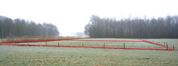
Baarle-Hertog is noted for its complicated borders with Baarle-Nassau, Netherlands.[2] In total it consists of 24 separate parcels of land. The main division of Baarle-Hertog is Zondereigen (after its main hamlet) located north of the Belgian town of Merksplas. In addition there are twenty Belgian exclaves in the Netherlands and three other sections on the Dutch-Belgian border. There are also seven Dutch exclaves within the Belgian exclaves. Six of them are located in the largest one and a seventh in the second-largest one. An eighth Dutch exclave is located nearby Ginhoven.
Some houses in the region of Baarle-Hertog/Baarle-Nassau are divided between the two countries. There was a time when according to Dutch laws restaurants had to close earlier. For some restaurants on the border it meant that the clients simply had to change their tables to the Belgian side.[3] The border's complexity results from a number of equally complex medieval treaties, agreements, land-swaps and sales between the Lords of Breda and the Dukes of Brabant. Generally speaking, predominantly agricultural or built environments became constituents of Brabant and other parts devolved to Breda. These distributions were ratified and clarified as a part of the borderline settlements arrived at during the Treaty of Maastricht in 1843.
Many fireworks shops are found in Baarle-Hertog, owing to Belgian laws controlling the sale of fireworks that are more lenient than those in the Netherlands. Close to the end of the year many Dutch tourists come to Baarle-Hertog to buy fireworks to celebrate the new year.
Two villages in the municipality, Zondereigen and Ginhoven, are located in the main territory of Belgium.
-

Cafe in Baarle-Nassau, showing border between Belgium and the Netherlands
-

Church of Saint Remigius


List of the enclaves

| Serial # and Local Name [4] | Area (ha) | Notes |
|---|---|---|
| 153.6448 | Surrounded by Baarle-Nassau Commune, Netherlands; part of Baarle-Hertog Commune; forms a quadripoint with enclave H2; largest Belgian exclave encompasses six Dutch enclaves; consists of dwellings for the most part with outlying farmland and an industrial area; boundary runs through numerous buildings; contains a portion of the former Turnhout-Tilburg rail line, now a cyclepath | |
| 2.4116 | Surrounded by Baarle-Nassau Commune, Netherlands; part of Baarle-Hertog Commune; consists of farmland with a single point of connection (quadripoint) between enclaves H1 and H2 in the middle of a corn field | |
| 0.3428 | Surrounded by Baarle-Nassau Commune, Netherlands; part of Baarle-Hertog Commune; occupies part of a field; boundary runs through a shed in one instance | |
| 1.476 | Surrounded by Baarle-Nassau Commune, Netherlands; part of Baarle-Hertog Commune; consists of farmland; boundary runs through a house and three sheds | |
| 0.9245 | Surrounded by Baarle-Nassau Commune, Netherlands; part of Baarle-Hertog Commune; consists of farmland with a dwelling | |
| 1.7461 | Surrounded by Baarle-Nassau Commune, Netherlands; part of Baarle-Hertog Commune; has mixed land usage; boundary runs through a warehouse/factory | |
| 0.2469 | Surrounded by Baarle-Nassau Commune, Netherlands; part of Baarle-Hertog Commune; boundary runs through two dwellings, including the middle of one front door (giving it two house numbers: Loveren 2, Baarle-Hertog / Loveren 19, Baarle-Nassau) | |
| 41.8781 | Surrounded by Baarle-Nassau Commune, Netherlands; part of Baarle-Hertog Commune; second largest Belgian exclave, contains a mix of dwellings and farmland; boundary runs through a barn, a dwelling and two businesses | |
| 0.4005 | Surrounded by Baarle-Nassau Commune, Netherlands; part of Baarle-Hertog Commune; boundary runs through a printing factory/warehouse in an industrial area | |
| 0.65 | Surrounded by Baarle-Nassau Commune, Netherlands; part of Baarle-Hertog Commune; consists of farmland | |
| 0.93 | Surrounded by Baarle-Nassau Commune, Netherlands; part of Baarle-Hertog Commune; consists of farmland | |
| 0.2822 | Surrounded by Baarle-Nassau Commune, Netherlands; part of Baarle-Hertog Commune; consists of farmland | |
| 1.5346 | Surrounded by Baarle-Nassau Commune, Netherlands; part of Baarle-Hertog Commune; boundary runs through about 20 dwellings | |
| 0.7193 | Surrounded by Baarle-Nassau Commune, Netherlands; part of Baarle-Hertog Commune; boundary runs through about 13 dwellings | |
| 1.7211 | Surrounded by Baarle-Nassau Commune, Netherlands; part of Baarle-Hertog Commune; boundary runs through about 16 dwellings | |
| 4.4252 | Surrounded by Baarle-Nassau Commune, Netherlands; part of Baarle-Hertog Commune; boundary runs through a house and three sheds, with three turning points inside just one shed | |
| 14.9248 | Surrounded by Baarle-Nassau Commune, Netherlands; part of Baarle-Hertog Commune; rural area contains a portion of the former Turnhout-Tilburg rail line, now a cyclepath | |
| 2.9247 | Surrounded by Baarle-Nassau Commune, Netherlands; part of Baarle-Hertog Commune; consists of farmland | |
| 0.6851 | Surrounded by Baarle-Nassau Commune, Netherlands; part of Baarle-Hertog Commune; consists of several ponds and a field | |
| 1.1681 | Surrounded by Baarle-Nassau Commune, Netherlands; part of Baarle-Hertog Commune; consists of farmland | |
| 1.1845 | Surrounded by Baarle-Nassau Commune, Netherlands; part of Baarle-Hertog Commune; consists of farmland | |
| 0.2632 | Surrounded by Baarle-Nassau Commune, Netherlands, south of the village of Ulicoten; part of Baarle-Hertog Commune; occupies part of a field; nationality was contested from the 1830s until 1995 (remained unallocated to either country in boundary treaty of 26 April 1974) |
| Serial # and Local Name [4] | Area (ha) | Notes |
|---|---|---|
| 5.3667 | Counter-enclave surrounded by Belgian exclave, H1, in Baarle-Hertog; part of Baarle-Nassau Commune, Netherlands; contains a mix of dwellings and farmland; boundary of N1 and H1 runs through one building | |
| 1.3751 | Counter-enclave surrounded by Belgian exclave, H1, in Baarle-Hertog; part of Baarle-Nassau Commune, Netherlands; contains 8 dwellings | |
| 0.2863 | Counter-enclave surrounded by Belgian exclave, H1, in Baarle-Hertog; part of Baarle-Nassau Commune, Netherlands; boundary of N3 and H1 bisects the loading dock of a liquor store | |
| 1.2324 | Counter-enclave surrounded by Belgian exclave, H1, in Baarle-Hertog; part of Baarle-Nassau Commune, Netherlands; boundary of N4 and H1 runs through a warehouse, with vacant Dutch land to the rear of the warehouse | |
| 1.9212 | Counter-enclave surrounded by Belgian exclave, H1, in Baarle-Hertog; part of Baarle-Nassau Commune, Netherlands; boundary of N5 and H1 runs through a furniture showroom, a shed and a barn | |
| 1.4527 | Counter-enclave surrounded by Belgian exclave, H1, in Baarle-Hertog; part of Baarle-Nassau Commune, Netherlands; consists of farmland with two buildings | |
| 0.5812 | Counter-enclave surrounded by Belgian Oordeel exclave, H8, in Baarle-Hertog; part of Baarle-Nassau Commune, Netherlands; occupies part of a field | |
| 2.8528 | Farmland enclave situated within Zondereigen, Belgium, less than 50 meters south of the Dutch border; part of Baarle-Nassau Commune. |
Famous inhabitants
- Petrus Christus, 15th century painter
See also
References
- ↑ Population per municipality on 1 January 2013 (XLS; 607.5 KB)
- ↑ (Spanish) Map, pictures and infos on "Fronterasblog"
- ↑ Lua error in package.lua at line 80: module 'strict' not found.
- ↑ 4.0 4.1 Lua error in package.lua at line 80: module 'strict' not found.
External links
| Wikimedia Commons has media related to [[commons:Category:{{#property:P373}}|{{#property:P373}}]]. |
- Official Web site Baarle-Hertog (Dutch)
- Official Web site Baarle-Nassau (Dutch)
- The Baarle Enclaves outlined with Maps
- Barry Smith's Baarle Site (with maps)
- English Website about the Baarle Enclaves / with maps
- Photos from Baarle-Nassau/Hertog
- Jan S. Krogh's Geosite about the Baarles
- Photograph of H-22, the smallest enclave of B.-Hertog
- New York Times, Frugal Traveler Blog, August 2008 (Matt Gross) – see video of Baarle-Hartog in middle of page
- 'En Territoire Belge et a quarante centimetres de la frontiere' - English-language PhD thesis on the historical geography of Baale's enclaves, including photos and detailed maps
 |
Baarle-Nassau (NL-NB) | |
||
| Baarle-Nassau (NL-NB) | Baarle-Nassau (NL-NB) | |||
|
||||
| Merksplas | Turnhout |
