District electoral division
A district electoral division (DED; Irish: Toghroinn ceantair) is a former name given to a low-level territorial division in Ireland. In 1994, both district electoral divisions and wards (the equivalent of district electoral divisions within the five county boroughs) were renamed as electoral divisions (the boundaries and names of the DEDs and wards themselves remained unchanged).[citation needed] In the Republic of Ireland, DEDs are the smallest legally defined administrative areas in the state for which small area population statistics (SAPS) are published from the Census.[1] In the European Union, Local administrative units (LAUs) are basic components of Nomenclature of Territorial Units for Statistics (NUTS) regions. For each EU member country, two levels of Local Administrative Units (LAU) are defined: LAU-1 and LAU-2, which were previously called NUTS-4 and NUTS-5 respectively, until the NUTS regulation went into force in July 2003. The District electoral division is at the level of LAU-2. There are a total of 3,440 electoral divisions within the Republic of Ireland.
Contents
Origins
District electoral divisions originated as subdivisions of poor law unions, grouping a number of townlands together to elect one or more members to a Poor Law Board of Guardians.[citation needed] The boundaries of district electoral divisions were drawn by a Poor Law Boundary Commission, with the intention of producing areas of roughly equivalent "rateable value" (the total amount of rates that would be paid by all ratepayers in the DED) as well as population. This meant that while DEDs were almost always contiguous, they might bear little relation to natural community boundaries.
The Local Government (Ireland) Act 1898 established a system of county councils and urban and rural district councils and the district electoral divisions were then used to elect members to the district councils, with groups of DEDs combining to elect members to county councils.
Northern Ireland
After the partition of Ireland and the establishment of Northern Ireland, the new Unionist Government proceeded to redraw district electoral division boundaries in the six counties making up the new state. The Unionist Government and its supporters claimed that this redrawing was necessary because population changes had caused discrepancies in the population of DEDs and it was necessary to change the boundaries to equalise electorates.[2] Irish nationalists, on the other hand, claimed that the boundaries were being redrawn so as to gerrymander local councils, producing unionist-majority councils in areas where the majority of the population was nationalist. Certainly, the effect of the redrawing of boundaries was to dramatically reduce the number of local councils under nationalist control,[2] and examination of the archives of the Northern Ireland Government has shown[3] that the Ministry of Home Affairs (responsible for the boundary redrawing) worked closely with local Unionist associations to produce favourable results for the Unionist Party.
With the reform of local government in Northern Ireland in 1973, both county councils and urban and rural district councils were abolished and replaced by a smaller set of district councils. These councils were divided into wards, each ward containing a number of townlands or parts of townlands. As a result, district electoral divisions no longer exist in Northern Ireland and the groups of wards used for single transferable vote are known as "district electoral areas".
Republic of Ireland

In the Irish Free State (later to become the Republic of Ireland), the introduction of the single transferable vote for local government elections meant that district electoral divisions were grouped together to elect a number of members to the relevant councils. Rural district councils outside County Dublin were abolished in 1925, with the remaining councils in Dublin being abolished in 1930. This meant that district electoral divisions no longer had any electoral purpose in their own right. However, they continued to be used for other administrative purposes; such as low-level census divisions, and building blocks for delimiting Dáil constituencies. Electoral areas for local authorities are not required to observe electoral division boundaries, though those for county councils usually do.[4]
Outside Dublin, most DED boundaries have remained unchanged since the 1850s. In County Dublin, however, the rapid increase in population of the city's suburbs has meant that district electoral divisions have been periodically redrawn so as to produce smaller divisions of a convenient size. In addition, the expansion of the city boundaries of Cork, Limerick and Waterford and the establishment of Galway as a county borough in 1985, required the redrawing of ward boundaries within the cities, and the consequent adjustment of the DEDs affected by the boundary changes.
Because the boundaries of district electoral divisions have largely remained unchanged since the nineteenth century, their populations vary widely, ranging from 32,305 for the electoral division of Blanchardstown-Blakestown in Fingal to 16 for the electoral divisions of Arigna in County Leitrim (figures from the 2006 Census of Population). District electoral division boundaries also tend to bear little relation to the boundaries of natural communities in rural Ireland such as parishes, with the result that most people will have little or no idea as to which electoral division they live in.
See also
References
- ↑ Central Statistics Office – Electoral Division Boundaries.
- ↑ 2.0 2.1 Lua error in package.lua at line 80: module 'strict' not found.
- ↑ The Factory of Grievances: Devolved Government in Northern Ireland, 1921–1939, Patrick Buckland, 1979, Gill & Macmillan, cited in Whyte, op. cit.
- ↑ Electoral Area Committees web site of the Dublin and Cities Electoral Area Boundary Committee and the Electoral Area Boundary Committee, drawing local electoral area boundaries.
External links
- Department of Agriculture and Food – Categories of Disadvantaged Areas Set of Excel spreadsheets, listing all townlands in the Republic of Ireland and the 1898 District Electoral Division they belong to.
- 2006 Census of Ireland Preliminary Report
- 2006 census boundaries, including EDs, in shapefile format for use in GIS.
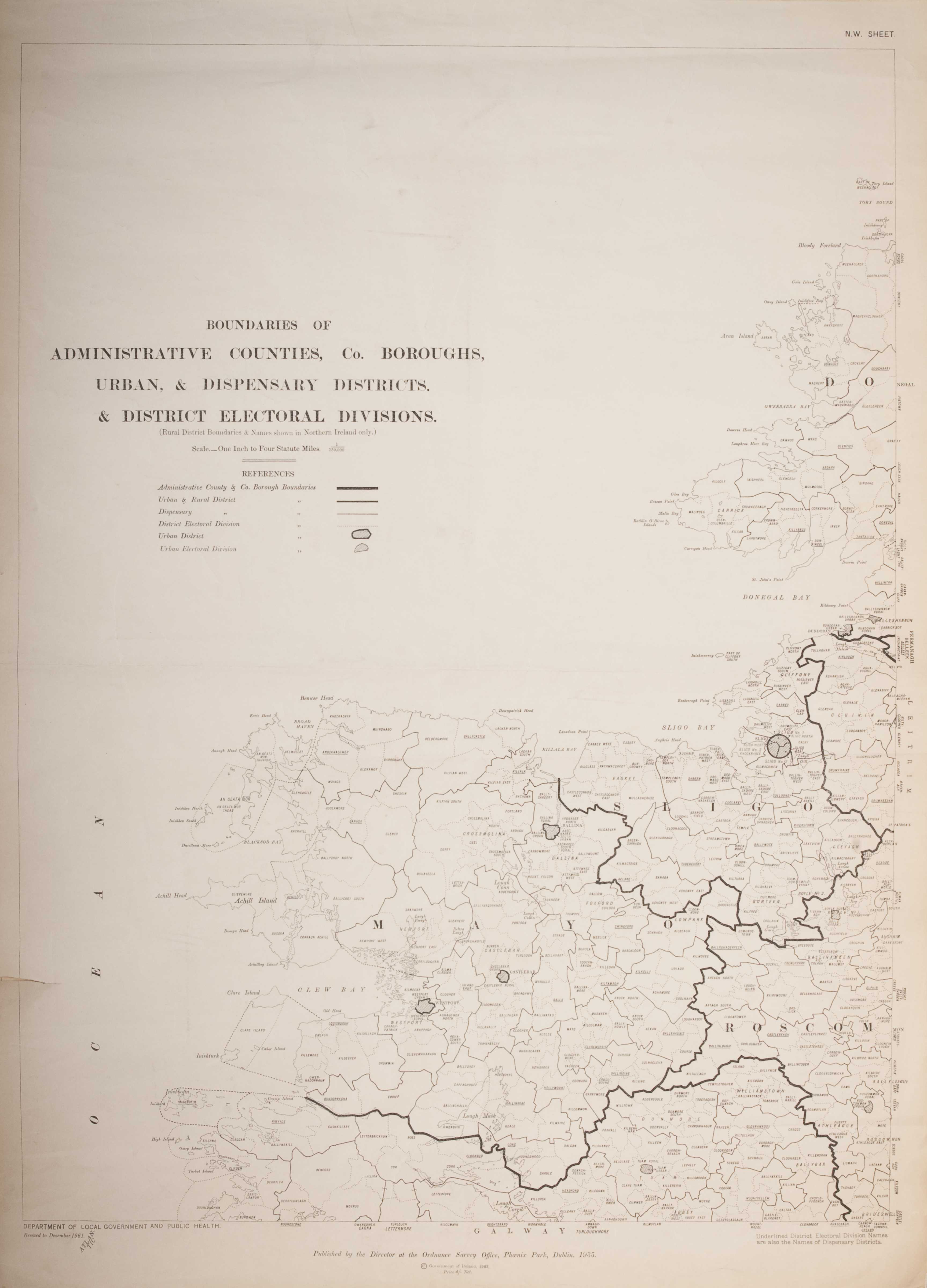
- Boundaries of Administrative Counties, Co. Boroughs, Urban & Dispensary Districts & District Electoral Divisions (Dublin 1962; 1st. published by the Ordnance Survey, 1935; revised 1961). JPEG format: Northeast;Northwest; Southeast;Southwest