File:Meskhetian turks 1926.png

Summary
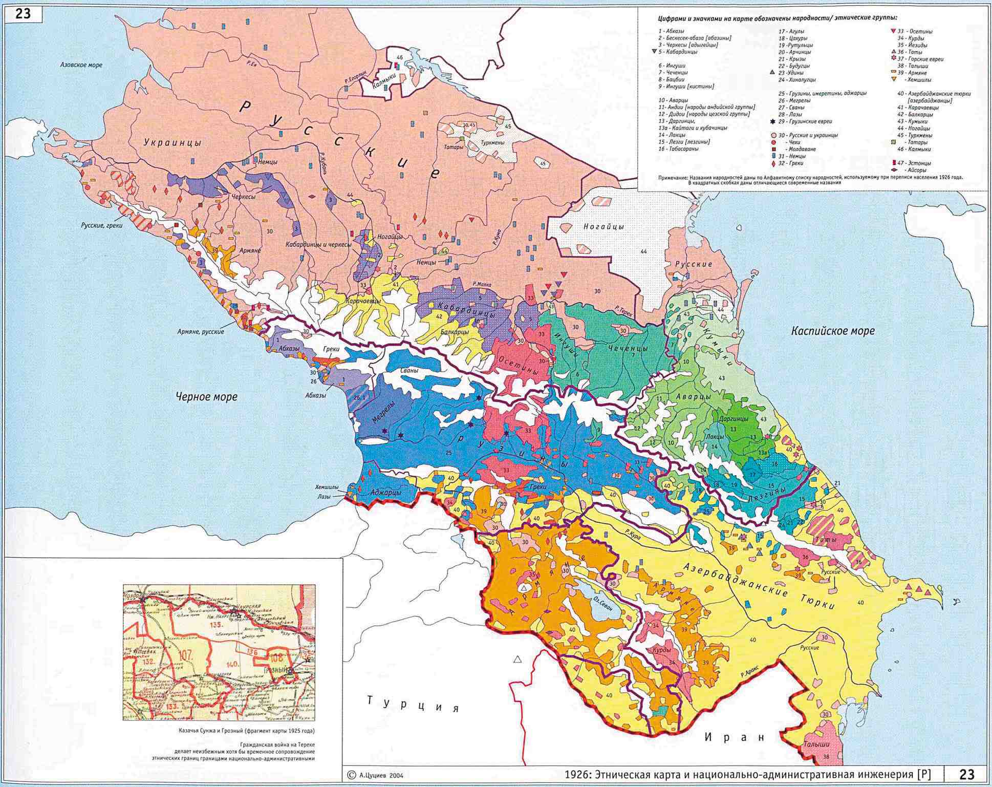
The settlement area of the <a href="https://en.wikipedia.org/wiki/Meskhetian_Turks" class="extiw" title="en:Meskhetian Turks">Meskhetian Turks</a> in Georgian SSR in 1926. My own work based on created based on <a rel="nofollow" class="external text" href="http://www.iriston.com/books/cuciev_-_etno_atlas/maps/map23.jpg">Ethnic map of Caucasus region, 1926</a> from <a rel="nofollow" class="external text" href="http://www.iriston.com/books/cuciev_-_etno_atlas/cuciev_etno-polit_map.htm">A. Tsutsayev's Atlas of Ethnopolitical Hisotry of the Caucasus, Moscow, 2007 (АТЛАС ЭТНОПОЛИТИЧЕСКОЙ ИСТОРИИ КАВКАЗА, Цуциев А.А, Москва: Издательство «Европа», 2007)</a>
Licensing
Lua error in package.lua at line 80: module 'strict' not found.
File history
Click on a date/time to view the file as it appeared at that time.
| Date/Time | Thumbnail | Dimensions | User | Comment | |
|---|---|---|---|---|---|
| current | 10:13, 7 January 2017 | | 1,099 × 578 (37 KB) | 127.0.0.1 (talk) | The settlement area of the <a href="https://en.wikipedia.org/wiki/Meskhetian_Turks" class="extiw" title="en:Meskhetian Turks">Meskhetian Turks</a> in Georgian SSR in 1926. My own work based on created based on <a rel="nofollow" class="external text" href="http://www.iriston.com/books/cuciev_-_etno_atlas/maps/map23.jpg">Ethnic map of Caucasus region, 1926</a> from <a rel="nofollow" class="external text" href="http://www.iriston.com/books/cuciev_-_etno_atlas/cuciev_etno-polit_map.htm">A. Tsutsayev's Atlas of Ethnopolitical Hisotry of the Caucasus, Moscow, 2007 (АТЛАС ЭТНОПОЛИТИЧЕСКОЙ ИСТОРИИ КАВКАЗА, Цуциев А.А, Москва: Издательство «Европа», 2007)</a> |
- You cannot overwrite this file.
File usage
The following page links to this file: