Al-Masara
| Al-Masara | |
|---|---|
| Other transcription(s) | |
| • Arabic | المعصرة |
| • Also spelled | Al-Ma'sara (official) |
| Protest in al-Masara
Protest in al-Masara
|
|
| Governorate | Bethlehem |
| Founded | 1930 |
| Government | |
| • Type | Local Development Committee |
| • Head of Municipality | Mahmoud Alaeddin |
| Area | |
| • Jurisdiction | 973 dunams (1.0 km2 or 0.4 sq mi) |
| Population (2007[1]) | |
| • Jurisdiction | 803 |
| Name meaning | "the Press" |
Al-Masara (Arabic: المعصرة, pronounced al-Ma'sara; translation: "the press") is a Palestinian village in the central West Bank, 6.2 km southwest of Bethlehem, part of the Bethlehem Governorate. It is surrounded by a number of smaller Palestinian villages including Khallet al-Haddad to the east.[2] The population was 803 in the 2007 census by the Palestinian Central Bureau of Statistics (PCBS).[1]
Its name "the press" derives from the Byzantine Empire-era olive press still located in al-Ma'sara.[2] In 1883 the Palestine Exploration Fund's Survey of Western Palestine (SWP) noted "heaps of stoned and cisterns" in the area.[3] The modern town was founded in 1930 by members of the Arab al-Zawahra and at-Ta'mirah tribes. A seven-member local development committee was established by the Palestinian National Authority (PNA) to administer the village, most which is located in Area B giving the PNA jurisdiction over al-Ma'sara's civil affairs.[2] The head of the committee is Mahmoud Alaeddin.[4]
There is one mosque, al-Ma'sara Mosque, a primary and secondary school in the village. Agriculture accounts for 70% of al-Ma'sara's economic activity while the civil sector make up 16%. The total land area is 973 dunams, of which 42 dunams are designated built-up. Most of the remainder is arable land, 505 dunams of which are cultivated.[2]
References
- ↑ 1.0 1.1 2007 PCBS Census. Palestinian Central Bureau of Statistics. p.117.
- ↑ 2.0 2.1 2.2 2.3 Al-Ma'sara Village Profile. Applied Research Institute-Jerusalem (ARIJ). 2010.
- ↑ Conder and Kitchener, 1883, SWP III, p. 359
- ↑ Masara Profile. Jerusalem Media and Communications Center (JMCC). 2007-02-09.
Bibliography
| Wikimedia Commons has media related to Al Ma'asara. |
- Lua error in package.lua at line 80: module 'strict' not found.
- Lua error in package.lua at line 80: module 'strict' not found. (p. 400)
External links
- Welcome To Kh. al-Ma'sara
- Al Ma'sara Village (Fact Sheet), ARIJ
- Al Ma’sara Village Profile, ARIJ
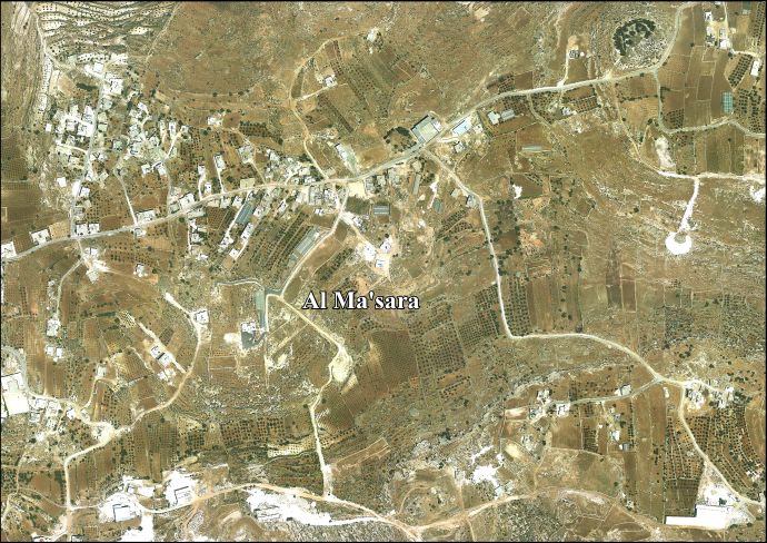
- Al Ma’sara areal photo, ARIJ
- SWP map 21, IAA
- SWP map 21, Wikimedia commons
