Gülyalı
From Infogalactic: the planetary knowledge core
| Gülyalı | |
|---|---|
| District | |
| Kestane, a village in Gülyalı district
Kestane, a village in Gülyalı district
|
|
 Location of Gülyalı within Turkey. |
|

Gülyalı
|
|
| Coordinates: Lua error in package.lua at line 80: module 'strict' not found. | |
| Country | |
| Region | Black Sea |
| Province | Ordu |
| Government | |
| • Mayor | Talip Şen (AKP) |
| Area[1] | |
| • District | 73.36 km2 (28.32 sq mi) |
| Elevation | 0 m (0 ft) |
| Population (2012)[2] | |
| • Urban | 3,383 |
| • District | 7,957 |
| • District density | 110/km2 (280/sq mi) |
| Time zone | EET (UTC+2) |
| • Summer (DST) | EEST (UTC+3) |
| Postal code | 52xxx |
| Area code(s) | 0452 |
| Licence plate | 52 |
| Climate | Cfa |
| Website | www.gulyali-bld.gov.tr |
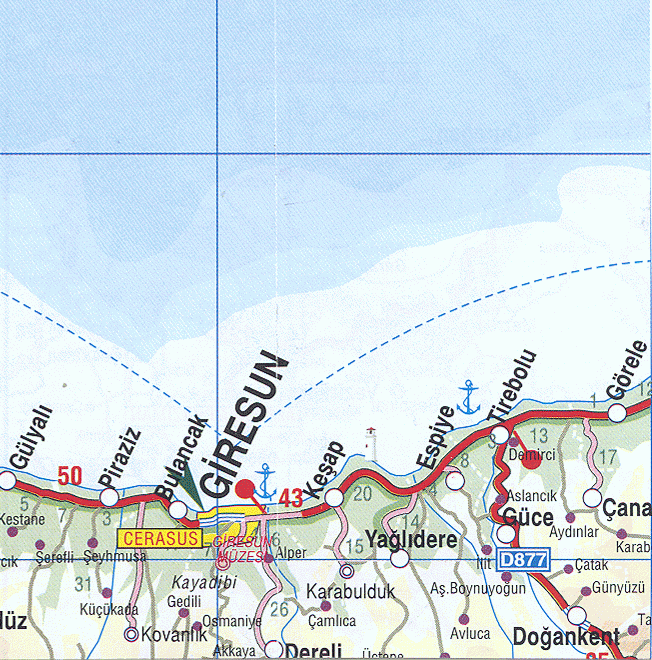
Gülyalı, formerly Abulhayır, is a town and district of Ordu Province in the Black Sea region of Turkey, 15 km east of the city of Ordu, towards Giresun. According to the 2000 census, population of the district is 10,566 of which 5,245 live in the town of Gülyalı.[3][4] The district covers an area of 73 km2 (28 sq mi),[5] and the town lies at an elevation of 0 m (0 ft).
The villages of Gülyalı district include Yeniköy, Ambarcılı, Ayrılık, Kestane, Mustafalı, Taşlıçay, and Turnasuyu.
Notes
- ↑ Lua error in package.lua at line 80: module 'strict' not found.
- ↑ Lua error in package.lua at line 80: module 'strict' not found.
- ↑ Lua error in package.lua at line 80: module 'strict' not found.
- ↑ Lua error in package.lua at line 80: module 'strict' not found.
- ↑ Lua error in package.lua at line 80: module 'strict' not found.
References
- Lua error in package.lua at line 80: module 'strict' not found.
External links
- District governor's official website (Turkish)
- Road map of Gülyalı and environs
- Various images of Gülyalı, Ordu
Lua error in package.lua at line 80: module 'strict' not found.
<templatestyles src="Asbox/styles.css"></templatestyles>
|
This geographical article about a location in Ordu Province, Turkey is a stub. You can help Wikipedia by expanding it. |