Cruzville, New Mexico
From Infogalactic: the planetary knowledge core
| Cruzville, New Mexico | |
|---|---|
| Census-designated place | |

Cruzville
|
|
| Coordinates: Lua error in package.lua at line 80: module 'strict' not found.[1] | |
| Country | United States |
| State | New Mexico |
| County | Catron |
| Area | |
| • Total | 2.5 sq mi (6.6 km2) |
| • Land | 2.5 sq mi (6.6 km2) |
| • Water | 0 sq mi (0 km2) |
| Population (2010) | |
| • Total | 72 |
| • Density | 28/sq mi (10.9/km2) |
| Time zone | Mountain (MST) (UTC-5) |
| • Summer (DST) | MDT (UTC) |
| Area code(s) | 575 |
Cruzville is a census-designated place in Catron County, New Mexico, United States, 9 miles (14 km) northeast of Reserve. It is located in the Apache National Forest.[2] As of the 2010 census it had a population of 72.[3]
References
- ↑ U.S. Geological Survey Geographic Names Information System: Cruzville, New Mexico
- ↑ Banks, P.H. (nd) Cruzville, Apache Creek, Aragon and Old Horse Springs — NM Hwy12 from Reserve to Datil. SouthernNewMexico.com. Retrieved 6/13/07.
- ↑ Lua error in package.lua at line 80: module 'strict' not found.
External links
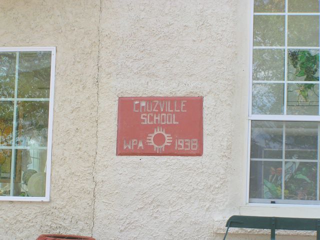
- Photo of Cruzville School built by the Works Progress Administration in 1938.
|
Municipalities and communities of Catron County, New Mexico, United States
|
||
|---|---|---|
| Village |
 |
|
| CDPs | ||
| Other unincorporated communities |
||
| Ghost towns | ||
<templatestyles src="Asbox/styles.css"></templatestyles>
|
This New Mexico state location article is a stub. You can help Wikipedia by expanding it. |